Advances in satellite monitoring of abandoned mines and ille
2016-02-20
Cross mine remediation services company Crosstech and Swiss Mining Fund branches for Hans about in - Ebel (hansj? RG Eberle) said that using satellite images to monitor the abandoned mines and illegal mining activities has become possible.
Crosstech, together with the software company Sarmap, under the auspices of the European Space Agency (), the European Space Agency (ESA), is trying to explore the technological process through a Xiang Yingyong research project.
Eber said that this system is particularly suitable for South Africa, because the country's abandoned mines and illegal mining activity monitoring is very difficult. And the mining industry in the doldrums, abandoned and sealed the number of mines increased. The company is looking for partners, including the government or business organizations to participate in this demonstration project. This research project is part of the EU's space agency communications system advanced research 20 integrated application promotion program. The purpose is to integrate at least two kinds of different spatial data, such as satellite communications, earth observation, satellite remote sensing and aerospace technology, to provide products or services to the market. Although many scholars have published many technical aspects of the paper, but these technologies are not integrated to create products or services.
Eber, for example, synthetic aperture radar can be detected at different times of the millimeter level image changes. This technology can help to detect whether the dam displacement, whether there is erosion within the dam, the ground is the settlement. These small changes after long-term accumulation can have disastrous consequences, such as the Brazil tailings dam break event.
Using this technology can also track the long-term changes in a region, if you can get 20 years of image data, you can be able to determine what changes in the region's history.
To promote the technology innovation is the use of satellite images, these images have been available free of charge, such as the European Union's space agency Sentinel on earth observation satellite image data.
The speed of access to satellite imagery is faster, in some cases, or even monthly or weekly updates, which makes it possible to monitor real time.
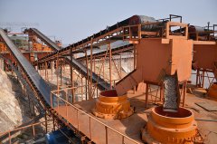
Remote sensing monitoring of mine environment can be carried out by using the above mentioned techniques. Most mineral company and regulators take the methods of placing sensors at some point. This method is only suitable for a mine, if need to monitor dozens or hundreds of mines, efficiency will be greatly reduced.
Eber said, according to the actual requirements of the user to customize the monitoring system. Through the Internet, end products can be updated regularly, including a detailed map of the risk for geologists customized, as well as a high risk maps with interpretation and decision-making instructions.